Goal of FUEGO
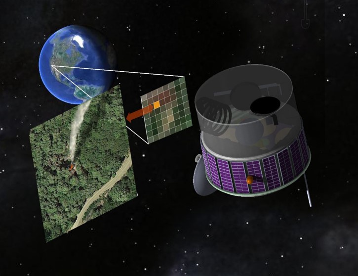
The Fire Urgency Estimator in Geostationary Orbit (FUEGO) Mission will continuously observe a large area of the Earth (primarily the western US) to rapidly identify the ignition of wildland fires and track their motions.
FUEGO provides agencies and fire fighters on the ground with real-time actionable information that has vastly higher spatial resolution and is updated more frequently than is currently available. We envision that the imagery and notifications from FUEGO will feed into an integrated fire information and management system to help limit the destruction from wildfires.


The Wildfire Problem
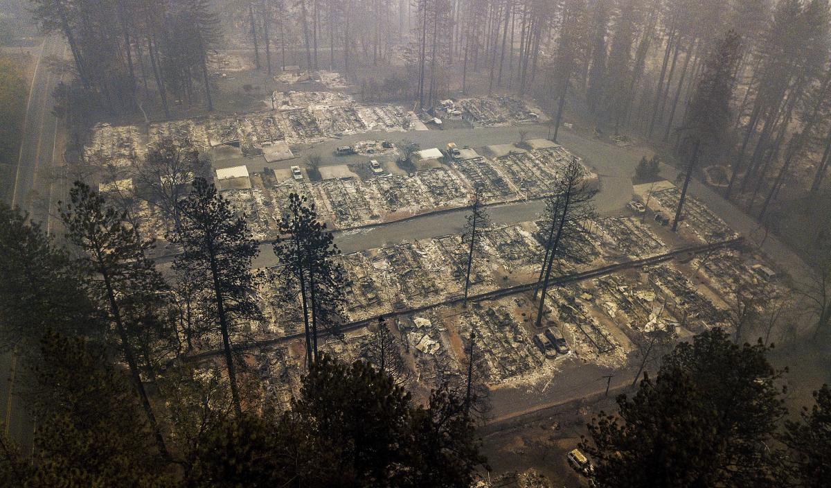
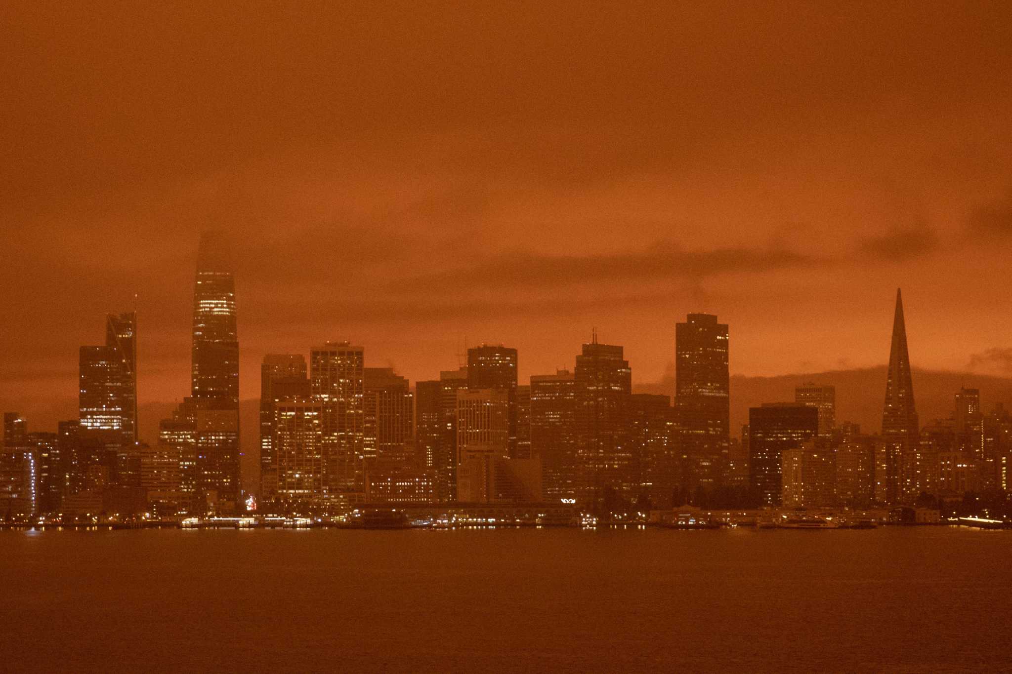
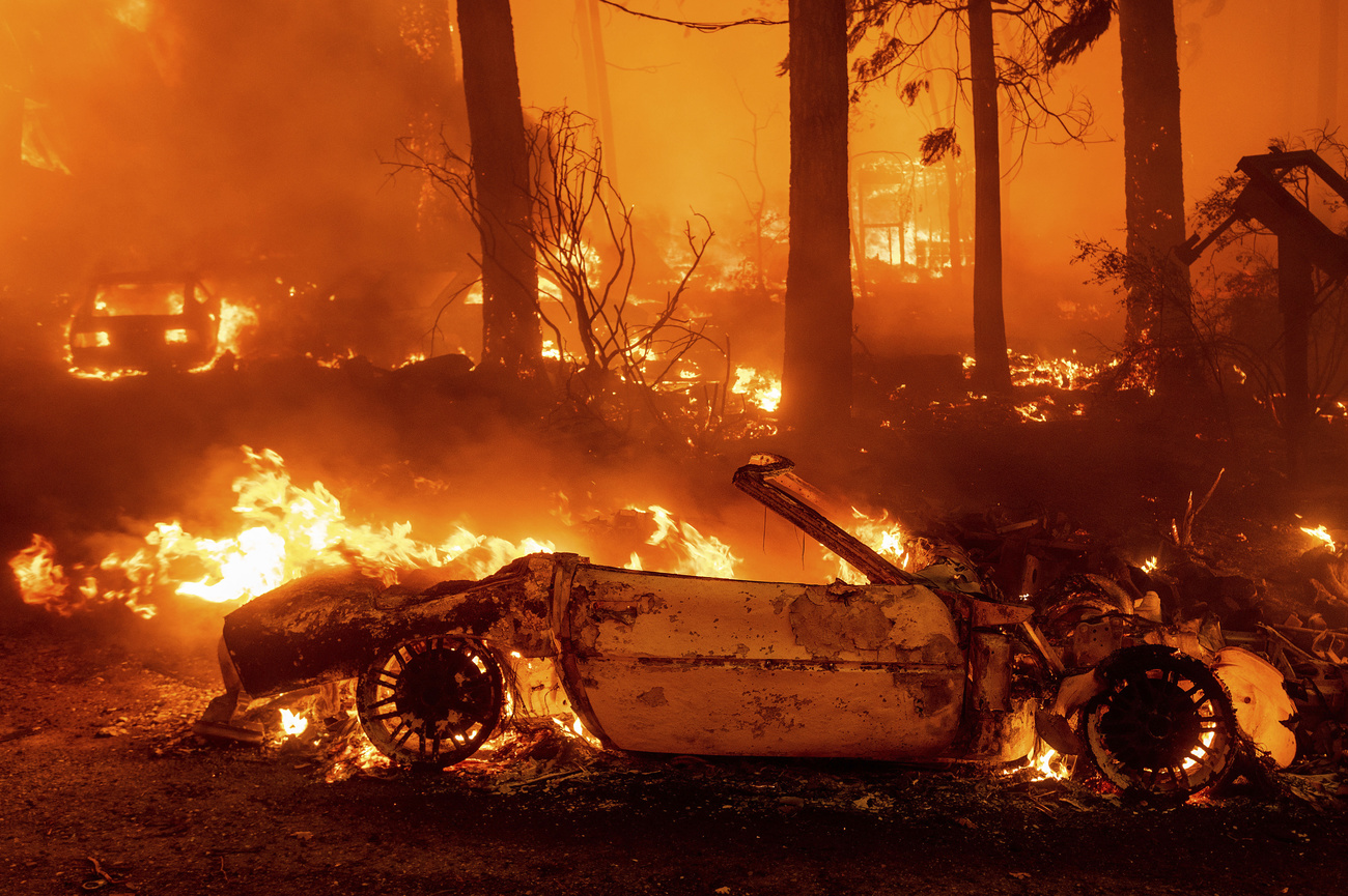
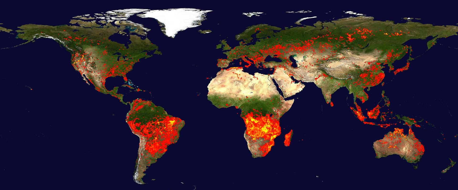
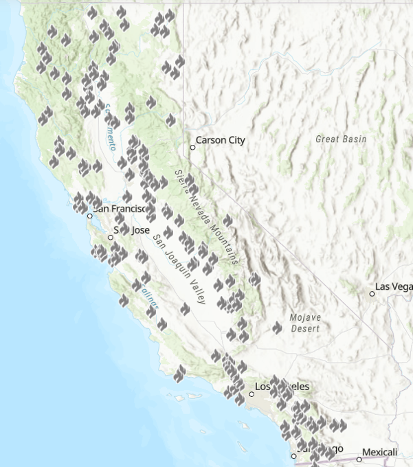
Wildfires have become a larger and larger problem in recent years due to both their increased intensity and greater areal extent. The consequences of their increased intensity are most dramatically displayed by the almost complete destruction of the town of Paradise, CA. The Camp Fire was the deadliest and most destructive wildfire in California’s history, and the most expensive natural disaster in the world in 2018 in terms of insured losses. The fire caused at least 85 civilian fatalities. It covered an area of 153,336 acres (620.5 km2), and destroyed more than 18,000 structures, with most of the destruction occurring within the first four hours. By January 2019, the total damage was estimated at $16.5 billion. The Camp Fire also cost over $150 million in fire suppression costs, bringing the total cost of the fire to $16.65 billion [Wikipedia, Camp fire].
Reasons for the increased wildfire intensity and destruction are manifold, the most important being accumulation of flammable material in forests, severe droughts due to climate change, and the increased spread of human housing and infrastructure into the wilderness.
Consequences of large wildfires are not only the loss of human and wild animal life, destruction of human infrastructure, generation of huge amounts of smoke and carbon dioxide emissions into the air, but also interruption of human activities, destruction of natural beauty, and the loss of recreational possibilities.
Our solution
To prevent wildfire destruction, information on the fire’s initiation and spread is critical. We propose providing time-sensitive information by continuous monitoring the western US from a geostationary satellite. Such a system could detect a 1000 Kelvin fire that covers an area of approximately 22 square meters. After the initial alert, the instrument will monitor the progression of the fire in near real-time (1 minute latency), with actionable data transmitted to fire teams within a few minutes of acquisition. FUEGO Map, a current data system, now puts FUEGO data in the hands of fire teams in an accessible format for emergency response guidance. In our pilot program FUEGO Map, integrating data from our ground cameras into geographic context has already helped guide the responses of incident commanders.
Funding source
In July 2021 the team received a $1.5 million grant from the Gordon and Betty Moore Foundation as seed money to develop the concept of FUEGO and start the teaming process with partners in industry and government agencies. More details can be found at https://vcresearch.berkeley.edu/news/15-million-grant-will-improve-wildfire-spotting-air-and-space